


Basics
- Location:
- Near Steamboat Springs
- Setting:
- Mountainous
- Length:
- 13 mile roundtrip
- Difficulty:
- Intermediate,
Difficult
- Time:
- 6 to 7 hours
- Trailhead Elevation:
- 7600 feet
- Elevation Change:
- 1000 feet
- Season:
- Spring, Summer, Fall
Basic Directions
Take Hwy. 40 west of Steamboat Springs about 2 miles and turn right on to County Road 129. Travel north about 18 miles to the Seedhouse Road (FDR 400; also CR 64) and turn right. Continue for 4.5 miles to the #1188 sign. Park on the side of 400 or turn left onto FDR 429, travel 1/10th mile to the 1188 trailhead and park here.
Description
Trail #1188
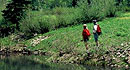
The Coulton Creek trail is accessible earlier in the season because of its lower elevation. The snow clears, but the trail does remain wet until later June. Solitude seekers will enjoy this moderate hike along with its views of the Elk River Valley, wildflower meadows and aspen groves. These groves of aspen are rewarding later with the change of season and the brilliance of fall colors. Expect moderate use of this trail during hunting seasons. Orange vests are advisable this time of year.
Coulton Creek Trail begins climbing through clear areas and into aspen groves providing the first views of the Elk River Valley. Soon the trail will split while crossing over FDR 429; take the right hand trail. The hiker will continue to climb and level off and climb again coming to meadows. Once you cross FDR 429 again, the trail forks again. To continue on trail 1188 continue left to its dead end, approximately 1 mile from the base of Farwell mountain. This hike offers a popular 7.8 mile alternative loop that will take the hiker back to Seedhouse road by following trail 1188 to its second fork, the Cutover Trail #1188A, crossing over to Hinman Creek Trail #1177 (turn right) and on back to Seedhouse road. It is an additional 1.5 miles back to the 1188 trailhead on the road surface.
Tour Companies
Vista Verde Guest Ranch - Hiking
- Near Steamboat Springs
- Hiking
- 970-879-3858
 At Vista Verde Ranch, hiking is one of the many activities you can try during your all-inclusive Colorado ranch vacation. Our guides offer a customized outdoor experience whether you want to rock climb, mountain bike, fly fish or horseback ride.
Helpful Links
Tour Companies
Vista Verde Guest Ranch - Hiking
- Near Steamboat Springs
- Hiking
- 970-879-3858
Details
Location:
Setting:
Length:
Difficulty:
Difficult

